Building Electricity Networks
The preparation process of the PyPSA-Eur energy system model consists of a group of snakemake
rules which are briefly outlined and explained in detail in the sections below.
Not all data dependencies are shipped with the git repository.
Instead we provide separate data bundles which can be obtained
using the retrieve* rules (Retrieving Data).
Having downloaded the necessary data, it can build a base PyPSA network with the following rules
- build_shapes generates GeoJSON files with shapes of the countries, exclusive economic zones and NUTS3 areas.
- base_network builds and stores the base network with all buses, HVAC lines and HVDC links, and determines Voronoi cells for all substations.
The network is then simplified by preparing approximations of the network model, for which it is computationally viable to co-optimize generation, storage and transmission capacities.
- simplify_network transforms the transmission grid to a 380 kV only equivalent network, while
- cluster_network uses a k-means based clustering technique to partition the network into a given number of zones and then reduce the network to a representation with one bus per zone.
The simplification and clustering steps are described in detail in the paper
- Jonas Hörsch and Tom Brown. The role of spatial scale in joint optimisations of generation and transmission for European highly renewable scenarios), 14th International Conference on the European Energy Market, 2017. arXiv:1705.07617, doi:10.1109/EEM.2017.7982024.
Then, the process continues by calculating conventional power plant capacities, potentials, and per-unit availability time series for variable renewable energy carriers and hydro power plants with the following rules:
- build_powerplants for today's thermal power plant capacities using powerplantmatching allocating these to the matching clustered region for each powerplant,
- determine_availability_matrix for the land eligibility analysis of each cutout grid cell for PV, onshore and offshore wind,
- build_renewable_profiles for the hourly capacity factors and installation potentials constrained by land-use in each substation's Voronoi cell for PV, onshore and offshore wind, and
- build_hydro_profile for the hourly per-unit hydro power availability time series.
The rules add_electricity and prepare_network then tie all the different data inputs
together into a detailed PyPSA network stored in networks/base_s_{clusters}_elec.nc.
Rule build_cutout
Create cutouts with atlite.
For this rule to work you must have
- installed the Copernicus Climate Data Store
cdsapipackage (install withpip``) and - registered and setup your CDS API key as described on their website.
See also: For details on the weather data read the atlite documentation. If you need help specifically for creating cutouts the corresponding section in the atlite documentation should be helpful.
Outputs
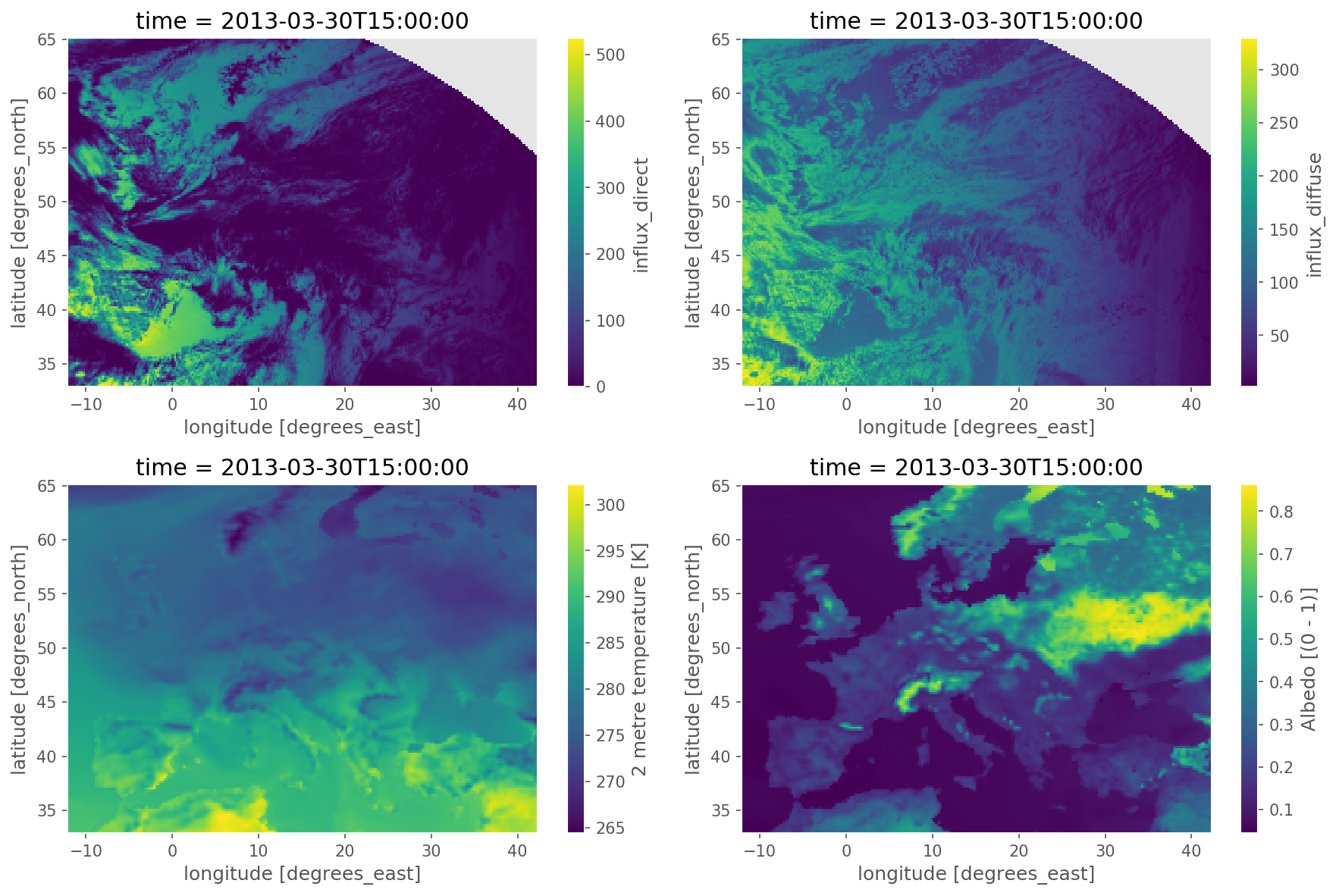
cutouts/{cutout}: weather data from either the ERA5 reanalysis weather dataset or SARAH-3 satellite-based historic weather data with the following structure:
ERA5 cutout:
| Field | Dimensions | Unit | Description |
|---|---|---|---|
| pressure | time, y, x | Pa | Surface pressure |
| temperature | time, y, x | K | Air temperature 2 meters above the surface. |
| soil temperature | time, y, x | K | Soil temperature between 1 meters and 3 meters depth (layer 4). |
| influx_toa | time, y, x | Wm**-2 | Top of Earth's atmosphere TOA incident solar radiation |
| influx_direct | time, y, x | Wm**-2 | Total sky direct solar radiation at surface |
| runoff | time, y, x | m | Runoff (volume per area) |
| roughness | y, x | m | Forecast surface roughness (roughness length) |
| height | y, x | m | Surface elevation above sea level |
| albedo | time, y, x | -- | Albedo measure of diffuse reflection of solar radiation. Calculated from relation between surface solar radiation downwards (Jm-2) and surface net solar radiation (Jm-2). Takes values between 0 and 1. |
| influx_diffuse | time, y, x | Wm**-2 | Diffuse solar radiation at surface. Surface solar radiation downwards minus direct solar radiation. |
| wnd100m | time, y, x | ms**-1 | Wind speeds at 100 meters (regardless of direction) |
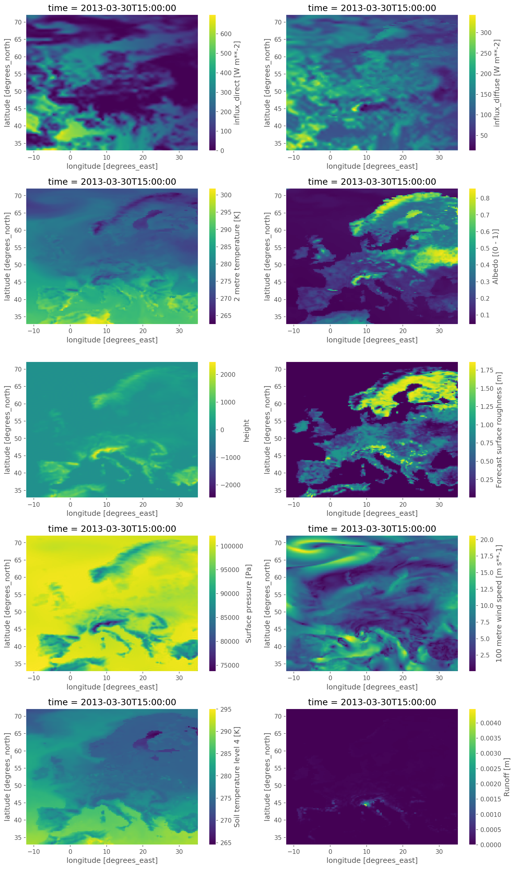
A SARAH-3 cutout can be used to amend the fields temperature, influx_toa, influx_direct, albedo,
influx_diffuse of ERA5 using satellite-based radiation observations.
Rule build_osm_boundaries
Rule clean_osm_data
This script is used to clean OpenStreetMap (OSM) data for creating a PyPSA-Eur ready network.
The script performs various cleaning operations on the OSM data, including: - Cleaning voltage, circuits, cables, wires, and frequency columns - Splitting semicolon-separated cells into new rows - Distributing values to circuits based on the number of splits - Adding line endings to substations based on line data
Rule build_osm_network
Rule build_tyndp_network
Rule base_network
Creates the network topology from a ENTSO-E map extract. (March 2022) or OpenStreetMap data (Aug 2024) as a PyPSA network.
Description
Creates the network topology from an ENTSO-E map extract, and create Voronoi shapes for each bus representing both onshore and offshore regions.
Rule build_natura
Rasters the vector data of the Natura 2000. natural protection areas onto all cutout regions.
Relevant Settings
.. code:: yaml
renewable:
    {technology}:
        cutout:
See also: Documentation of the configuration file config/config.yaml at renewable_cf
Inputs
-
data/bundle/natura/Natura2000_end2015.shp: Natura 2000 natural protection areas.
Outputs
-
resources/natura.tiff: Rasterized version of Natura 2000 natural protection areas to reduce computation times.
Description
Rule build_transmission_projects
Gets the transmission projects defined in the config file, concatenates and deduplicates them. Projects are later included in add_electricity.
Inputs
networks/base_network.nc: Base network topology for the electricity grid. This is processed in base_network.data/transmission_projects/"project_name"/: Takes the transmission projects from the subfolder of data/transmission_projects. The subfolder name is the project name.offshore_shapes.geojson: Shapefile containing the offshore regions. Used to determine if a new bus should be added for a new line or link.europe_shape.geojson: Shapefile containing the shape of Europe. Used to determine if a project is within the considered countries.
Outputs
transmission_projects/new_lines.csv: New project lines to be added to the network. This includes new lines and upgraded lines.transmission_projects/new_links.csv: New project links to be added to the network. This includes new links and upgraded links.transmission_projects/adjust_lines.csv: For lines which are upgraded, the decommissioning year of the existing line is adjusted to the build year of the upgraded line.transmission_projects/adjust_links.csv: For links which are upgraded, the decommissioning year of the existing link is adjusted to the build year of the upgraded link.transmission_projects/new_buses.csv: For some links, we have to add new buses (e.g. North Sea Wind Power Hub).
Rule build_line_rating
Calculates dynamic line rating time series from base network.
Description
The rule build_line_rating calculates the line rating for transmission lines. The line rating provides the maximal capacity of a transmission line considering the heat exchange with the environment.
The following heat gains and losses are considered:
- heat gain through resistive losses
- heat gain through solar radiation
- heat loss through radiation of the transmission line
- heat loss through forced convection with wind
- heat loss through natural convection
With a heat balance considering the maximum temperature threshold of the transmission line, the maximal possible capacity factor "s_max_pu" for each transmission line at each time step is calculated.
Rule add_transmission_projects_and_dlr
Rule build_bidding_zones
Combines bidding zone shape files from two sources. The electricitymaps-contrib data is more accurate and are used as the baseline. The Italian bidding zones from entsoe-py are more preferred and are used to override the baseline. Manual adjustments are made to match the TYNDP 2024 configuration. Small islands are removed and Crete is considered as independent of Greece. Southern Norwegian zones are merged.
Outputs
resources/bidding_zones.geojson:
Rule build_shapes
Creates GIS shape files of the countries, exclusive economic zones and NUTS3 <
https://en.wikipedia.org/wiki/Nomenclature_of_Territorial_Units_for_Statistics>_ and OSM ADM1 areas (for BA, MD, UA, and XK).
Rule build_electricity_demand_base
Rule build_electricity_demand
This rule downloads the load data from Open Power System Data Time series. For all countries in
the network, the per country load timeseries are extracted from the dataset.
After filling small gaps linearly and large gaps by copying time-slice of a
given period, the load data is exported to a .csv file.
Rule build_hac_features
Rule simplify_network
Lifts electrical transmission network to a single 380 kV voltage layer, removes dead-ends of the network, and reduces multi-hop HVDC connections to a single link.
Outputs
-
resources/regions_onshore_base.geojson: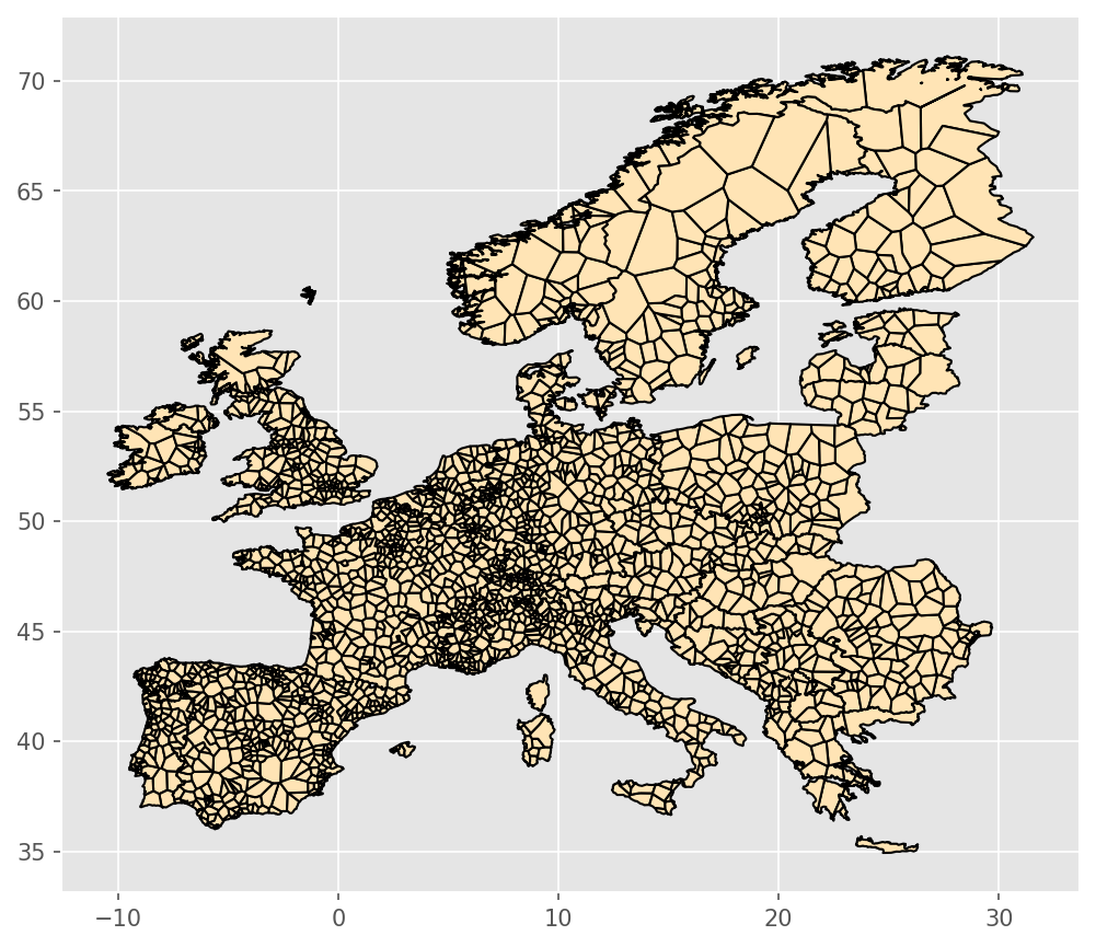
-
resources/regions_offshore_base.geojson: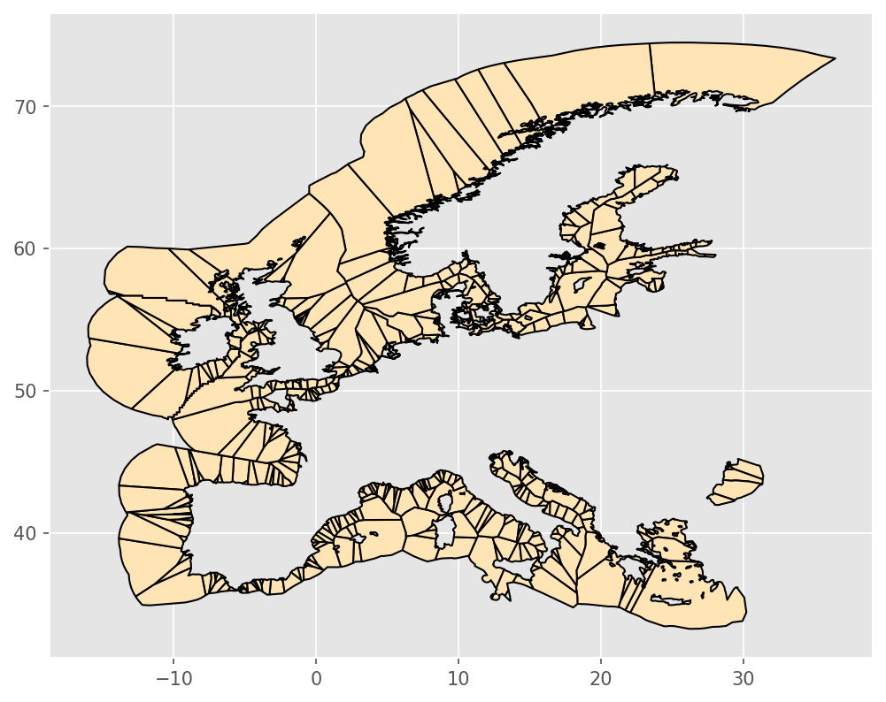
-
resources/busmap_base_s.csv: Mapping of buses fromnetworks/base.nctonetworks/base_s.nc; -
networks/base.nc: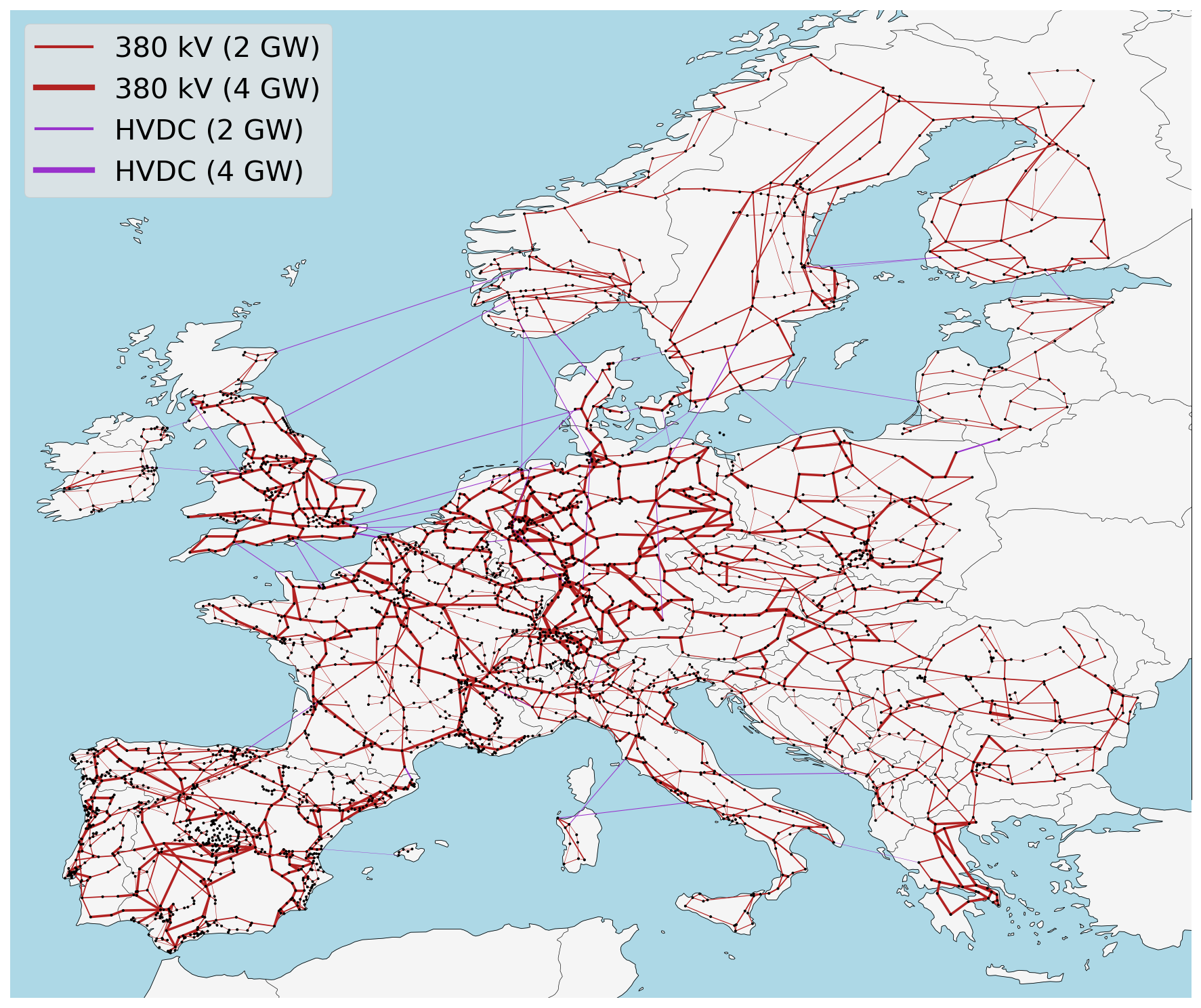
Description
The rule simplify_network does up to three things:
-
Create an equivalent transmission network in which all voltage levels are mapped to the 380 kV level by the function
simplify_network(...). -
DC only sub-networks that are connected at only two buses to the AC network are reduced to a single representative link in the function
simplify_links(...). -
Stub lines and links, i.e. dead-ends of the network, are sequentially removed from the network in the function
remove_stubs(...)andremove_stubs_within_admin(...).
Rule cluster_network
Creates networks clustered to {cluster} number of zones with aggregated
buses and transmission corridors.
Outputs
-
resources/regions_onshore_base_s_{clusters}.geojson: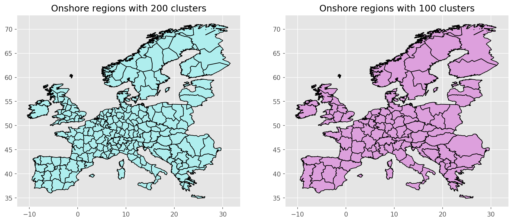
-
resources/regions_offshore_base_s_{clusters}.geojson: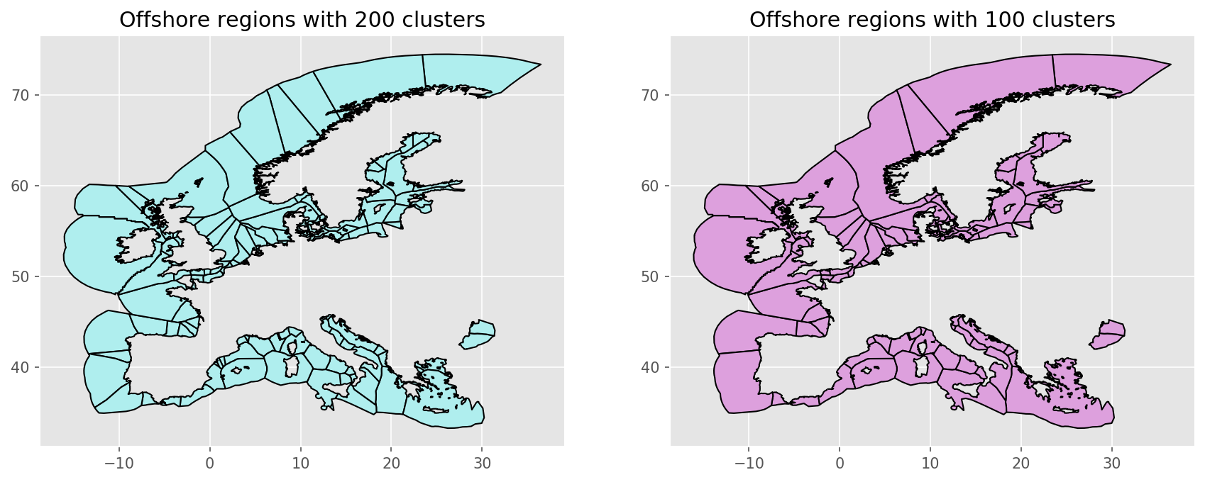
-
resources/busmap_base_s_{clusters}.csv: Mapping of buses fromnetworks/base.nctonetworks/base_s_{clusters}.nc; resources/linemap_base_s_{clusters}.csv: Mapping of lines fromnetworks/base.nctonetworks/base_s_{clusters}.nc;-
networks/base_s_{clusters}.nc: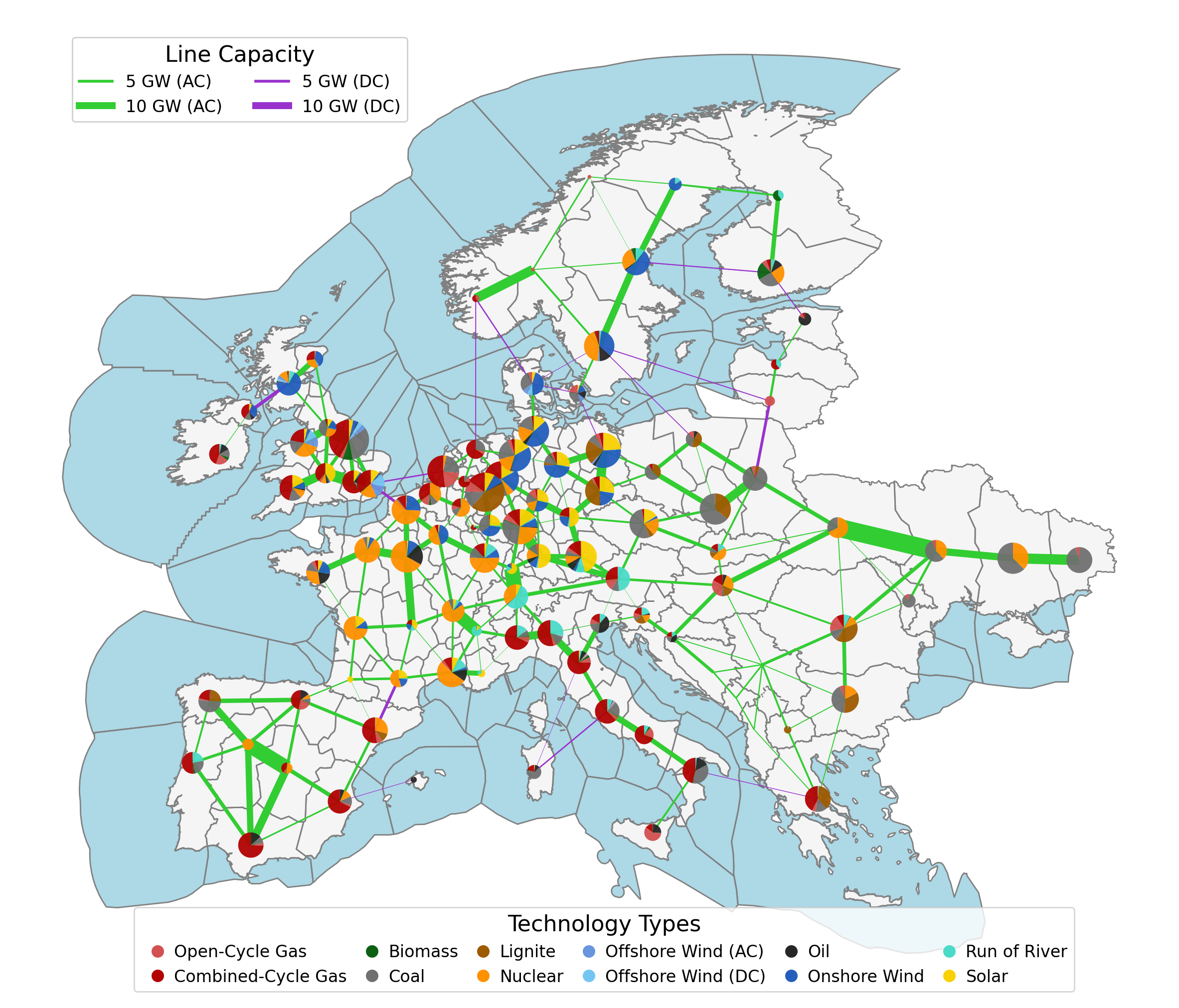
Description
Note: Is it possible to run the model without the simplify_network rule?
    No, the network clustering methods in the PyPSA module
    [pypsa.clustering.spatial](https://github.com/PyPSA/PyPSA/blob/master/pypsa/clustering/spatial.py)
    do not work reliably with multiple voltage levels and transformers.
Exemplary unsolved network clustered to 512 nodes:
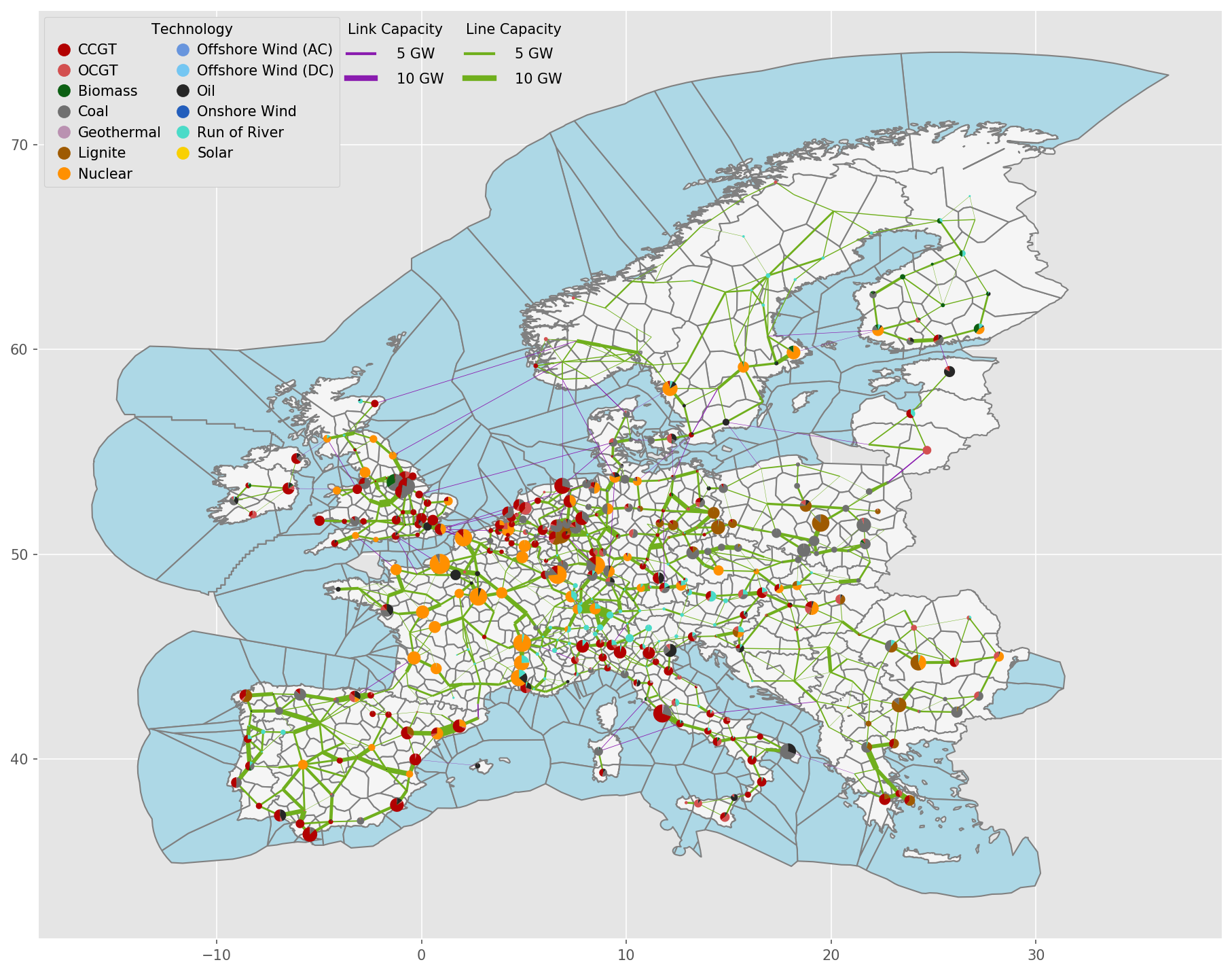
Exemplary unsolved network clustered to 256 nodes:

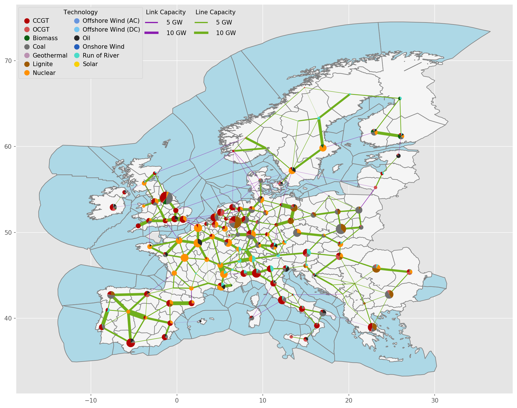
Exemplary unsolved network clustered to 128 nodes:
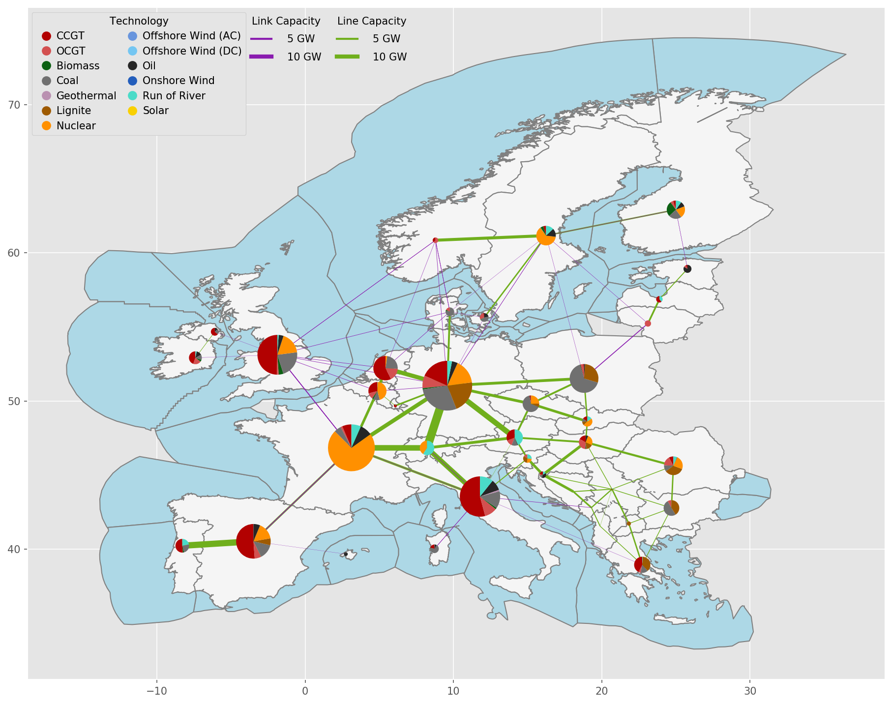
Exemplary unsolved network clustered to 37 nodes:
Rule build_monthly_prices
This script extracts monthly fuel prices of oil, gas and coal.
Description
The rule build_monthly_prices collects monthly fuel prices and translates them from different input sources to pypsa syntax.
Rule build_ship_raster
Transforms the global ship density data from the World Bank Data Catalogue. to the size of the considered cutout. The global ship density raster is later used for the exclusion when calculating the offshore potentials.
Outputs
resources/europe_shipdensity_raster.nc: Reduced version of global shipping traffic density from World Bank Data Catalogue to reduce computation time.
Description
Rule determine_availability_matrix_MD_UA
Rule determine_availability_matrix
The script performs a land eligibility analysis of what share of land is availability for developing the selected technology at each cutout grid cell. The script uses the atlite library and several GIS datasets like the CORINE land use data, LUISA land use data, Natura2000 nature reserves, GEBCO bathymetry data, and shipping lanes.
Inputs
-
data/bundle/corine/g250_clc06_V18_5.tif: CORINE Land Cover (CLC) inventory on 44 classes of land use (e.g. forests, arable land, industrial, urban areas) at 100m resolution.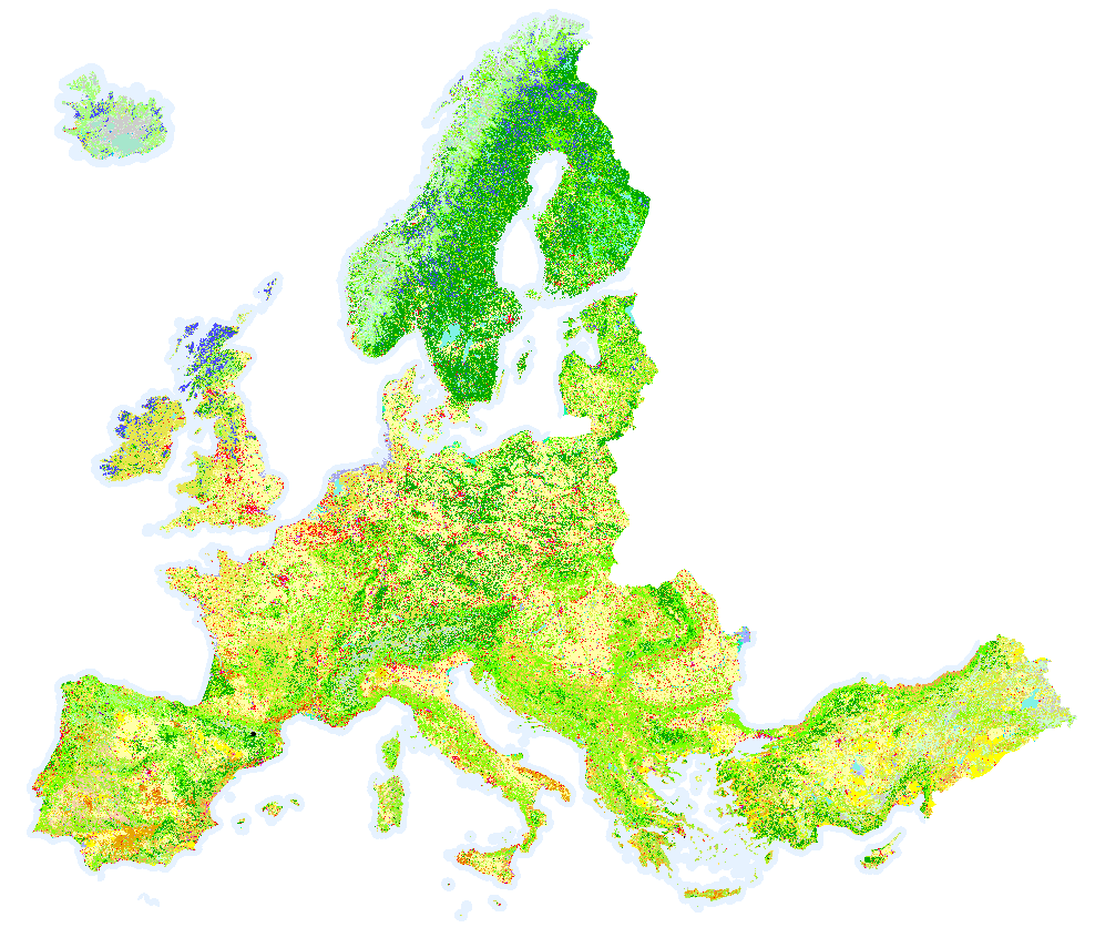
-
data/LUISA_basemap_020321_50m.tif: LUISA Base Map land coverage dataset at 50m resolution similar to CORINE. For codes in relation to CORINE land cover, see Annex 1 of the technical documentation. -
data/bundle/gebco/GEBCO_2014_2D.nc: A bathymetric data set with a global terrain model for ocean and land at 15 arc-second intervals by the General Bathymetric Chart of the Oceans (GEBCO).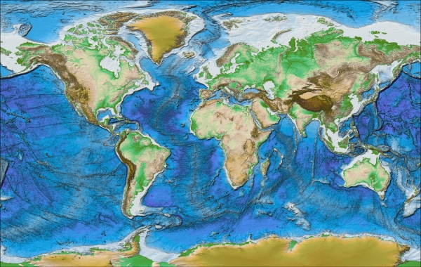
Source: GEBCO
-
resources/natura.tiff: confer natura resources/offshore_shapes.geojson: confer shapesresources/regions_onshore_base_s_{clusters}.geojson: (if not offshore wind), confer busregionsresources/regions_offshore_base_s_{clusters}.geojson: (if offshore wind), busregions"cutouts/" + params["renewable"][{technology}]['cutout']: cutoutnetworks/_base_s_{clusters}.nc: base
Outputs
resources/availability_matrix_{clusters_{technology}.nc
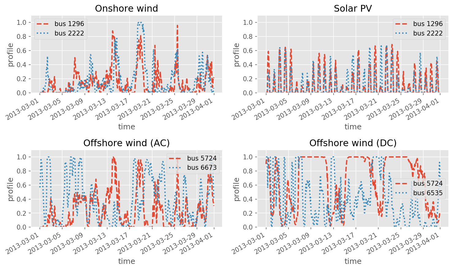
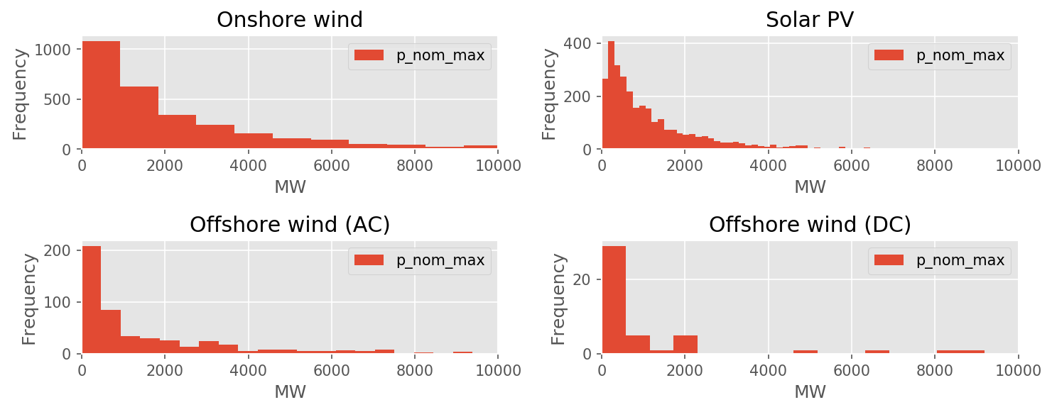
Rule build_renewable_profiles
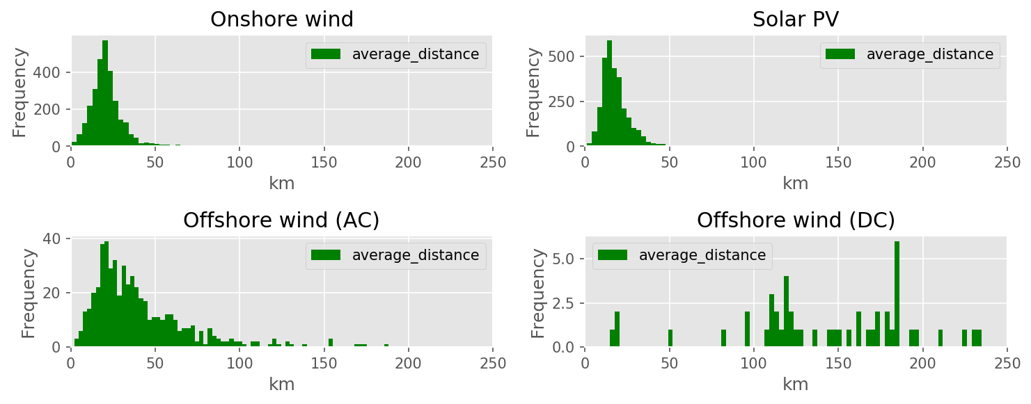
Calculates for each clustered region the (i) installable capacity (based on land-use from determine_availability_matrix), (ii) the available generation time series (based on weather data), and (iii) the average distance from the node for onshore wind, AC-connected offshore wind, DC-connected offshore wind and solar PV generators.
Note: Hydroelectric profiles are built in script build_hydro_profiles.
Outputs
resources/profile_{technology}.ncwith the following structure
| Field | Dimensions | Description |
|---|---|---|
| profile | year, bus, bin, time | the per unit hourly availability factors for each bus |
| p_nom_max | bus, bin | maximal installable capacity at the bus (in MW) |
| average_distance | bus, bin | average distance of units in the region to the grid bus for onshore technologies and to the shoreline for offshore technologies (in km) |
- profile
- p_nom_max
- average_distance
Description
This script functions at two main spatial resolutions: the resolution of the clustered network regions, and the resolution of the cutout grid cells for the weather data. Typically the weather data grid is finer than the network regions, so we have to work out the distribution of generators across the grid cells within each region. This is done by taking account of a combination of the available land at each grid cell (computed in determine_availability_matrix) and the capacity factor there.
Based on the availability matrix, the script first computes how much of the technology can be installed at each cutout grid cell. To compute the layout of generators in each clustered region, the installable potential in each grid cell is multiplied with the capacity factor at each grid cell. This is done since we assume more generators are installed at cells with a higher capacity factor.
Based on the average capacity factor, the potentials are further divided into a configurable number of resource classes (bins).
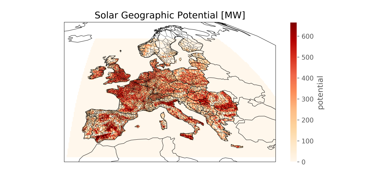
This layout is then used to compute the generation availability time series from
the weather data cutout from atlite.
The maximal installable potential for the node (p_nom_max) is computed by
adding up the installable potentials of the individual grid cells.
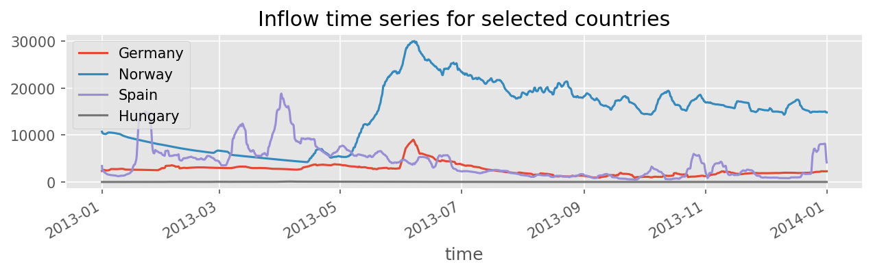
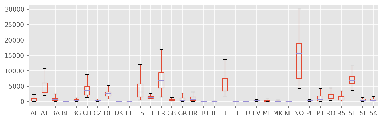
Rule build_hydro_profile
Build hydroelectric inflow time-series for each country.
Outputs
resources/profile_hydro.nc:
| Field | Dimensions | Description |
|---|---|---|
| inflow | countries, time | Inflow to the state of charge (in MW), e.g. due to river inflow in hydro reservoir. |
Rule build_powerplants
Retrieves conventional powerplant capacities and locations from
powerplantmatching, assigns
these to buses and creates a .csv file. It is possible to amend the
powerplant database with custom entries provided in
data/custom_powerplants.csv.
Lastly, for every substation, powerplants with zero-initial capacity can be added for certain fuel types automatically.
Outputs
-
resource/powerplants_s_{clusters}.csv: A list of conventional power plants (i.e. neither wind nor solar) with fields for name, fuel type, technology, country, capacity in MW, duration, commissioning year, retrofit year, latitude, longitude, and dam information as documented in the powerplantmatching README; additionally it includes information on the closest substation/bus innetworks/base_s_{clusters}.nc.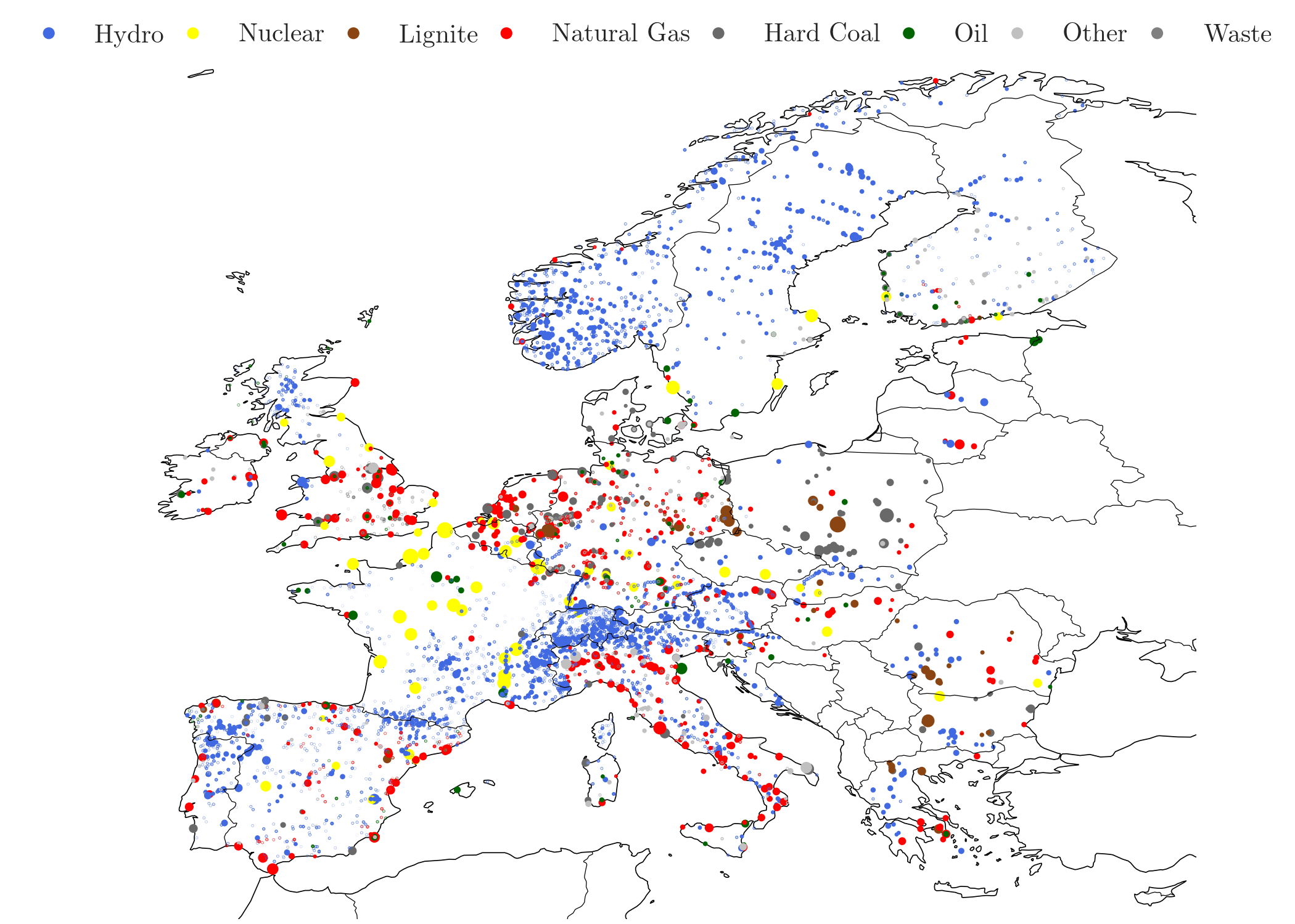
Source: powerplantmatching on GitHub
Description
The configuration options electricity: powerplants_filter and electricity: custom_powerplants can be used to control whether data should be retrieved from the original powerplants database or from custom amendments. These specify pandas.query commands.
In addition the configuration option electricity: everywhere_powerplants can be used to place powerplants with zero-initial capacity of certain fuel types at all substations.
-
Adding all powerplants from custom:
.. code:: yaml
powerplants_filter: false custom_powerplants: true -
Replacing powerplants in e.g. Germany by custom data:
.. code:: yaml
powerplants_filter: Country not in ['Germany']
custom_powerplants: true
or
.. code:: yaml
powerplants_filter: Country not in ['Germany'] custom_powerplants: Country in ['Germany'] -
Adding additional built year constraints:
.. code:: yaml
powerplants_filter: Country not in ['Germany'] and YearCommissioned <= 2015 custom_powerplants: YearCommissioned <= 2015 -
Adding powerplants at all substations for 4 conventional carrier types:
.. code:: yaml
everywhere_powerplants: ['Natural Gas', 'Coal', 'nuclear', 'OCGT']
Rule add_electricity
Adds existing electrical generators, hydro-electric plants as well as greenfield and battery and hydrogen storage to the clustered network.
Description
The rule add_electricity ties all the different data inputs from the
preceding rules together into a detailed PyPSA network that is stored in
networks/base_s_{clusters}_elec.nc. It includes:
- today's transmission topology and transfer capacities (optionally including
lines which are under construction according to the config settings
lines:
  under_construction` and `links: under_construction
), - today's thermal and hydro power generation capacities (for the technologies
listed in the config setting
electricity: conventional_carriers), and - today's load time-series (upsampled in a top-down approach according to population and gross domestic product)
It further adds extendable generators with zero capacity for
- photovoltaic, onshore and AC- as well as DC-connected offshore wind installations with today's locational, hourly wind and solar capacity factors (but no current capacities),
- additional open- and combined-cycle gas turbines (if
OCGTand/orCCGTis listed in the config settingelectricity: extendable_carriers)
Furthermore, it attaches additional extendable components to the clustered network with zero initial capacity:
-
StorageUnitsof carrier 'H2' and/or 'battery'. If this option is chosen, every bus is given an extendableStorageUnitof the corresponding carrier. The energy and power capacities are linked through a parameter that specifies the energy capacity as maximum hours at full dispatch power and is configured inelectricity: max_hours:. This linkage leads to one investment variable per storage unit. The defaultmax_hourslead to long-term hydrogen and short-term battery storage units. -
Storesof carrier 'H2' and/or 'battery' in combination withLinks. If this option is chosen, the script adds extra buses with corresponding carrier where energyStoresare attached and which are connected to the corresponding power buses via two links, one each for charging and discharging. This leads to three investment variables for the energy capacity, charging and discharging capacity of the storage unit.
Rule prepare_network
Prepare PyPSA network for solving according to opts, such as.
- adding an annual limit of carbon-dioxide emissions,
- adding an exogenous price per tonne emissions of carbon-dioxide (or other kinds),
- setting an N-1 security margin factor for transmission line capacities,
- specifying an expansion limit on the cost of transmission expansion,
- specifying an expansion limit on the volume of transmission expansion, and
- reducing the temporal resolution by averaging over multiple hours
or segmenting time series into chunks of varying lengths using
tsam.
Description
.. tip::
The rule prepare_elec_networks runs
for all scenario s in the configuration file
the rule prepare_network.